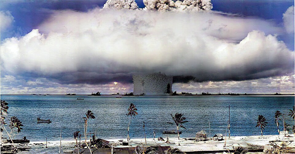
North Korea has often been the epicenter of geopolitical chaos between 2006 and 2017 due to its rampant nuclear tests. The last one was in 2017, and it ended in a heated exchange between the American president, Donald Trump, and North Korea’s dictator, Kim Jong Un. However, it wasn’t just diplomatic chaos; recent data suggest the nuclear tests have caused geological chaos that has persisted over the years.
The Shape of an Entire Mountain Changed
Between 2006 and 2017, North Korea conducted six underground nuclear tests, the last four of which were done at Punggye-ri, a vast testing site at Mount Mantap in North Hamgyong province. An underground explosion can trigger an intense burst of minor earthquakes that taper off once testing stops. However, rather than fading away as expected, seismic activity in Mount Mantap increased and even sped up through 2025. In fact, before the tests, no crustal earthquakes were detected within 50 kilometers (31 miles) of the site for over a century.
Concerned states around the world have kept track of telltale “rumble”— ground vibrations resulting from nuclear tests– to keep an eye on nuclear armament in countries that can threaten world peace. For years, forensic seismology has helped, though tracking such events from space has been limited.
That changed when Teng Wang from Nanyang Technological University in Singapore published a study in the journal Science based on a highly detailed 3D image of the landscape. Researchers combined Synthetic Aperture Radar (SAR) technology with satellite imagery to create a before-and-after map of Mount Mantap. Researchers speculated that the mountain lurched up by 2 meters (6 feet) and out by almost double that before settling back.
A recent study by an international research team led by Xingli Fan at Chengdu University of Technology ran computer models to see how Mount Mantap’s weight and shape stressed the rock beneath it. Heavy, steep slopes already put intense natural pressure on the rock beneath the mountain. Still, nuclear explosions over the years damaged the already stressed rock and changed the region’s seismic stability.
Tired Mountain Syndrome
Radar measurements and seismological data indicate that Mount Mantap is affected by “tired mountain syndrome”— weakening caused by repeated underground explosions. Repeated testing at the Punggye-ri test site didn’t allow the crust to rest. Massive pressure and heat hollowed out cavities, and increased seismic activity stressed a 15-mile fault system in the area. Scientists predict that a massive, reactivated 6.4 magnitude tectonic earthquake might hit the area in the coming days.
The Cannikin Test on Amchitka Island, USA (1971) caused a 6.9 magnitude earthquake from a 5-megaton detonation 6,100 feet below ground. The incident triggered fault movements and changed the island’s topography. Underground thermonuclear tests at the Nevada Test Site released huge amounts of energy, which caused fault lines 40 kilometers away to slip.
Historical evidence, along with years of monitored seismic data in the Mount Mantap, complicates monitoring under the Comprehensive Nuclear Test Ban Treaty, an organization based in Vienna that records seismological data and detects radioactive isotopes to track nuclear development in rogue nations. The ongoing activity makes it difficult to distinguish normal tremors from those linked to earlier explosions.
The Seismic Statistics
The team detected 1,399 small local earthquakes in the region. After the final test, seismicity in the area spiked over the years. The earthquakes were not random; instead, precise location data for 955 of these tremors lined up along two distinct, roughly parallel tracks stretching away from the test site.
One track followed a predicted continuation of a fault line geologists knew about. The second, however, was completely hidden and had never been mapped. Scientists believe that the crust was already structurally weak, and the explosions had damaged it further. However, the team couldn’t quite grasp why the earthquakes from a nuclear detonation didn’t fizzle out, and it turns out the mountain’s response to stress dictated the seismicity. The crust did not settle right away after the mountain lurched. Stresses redistributed through the damaged rock, causing nearby faults to slide years after the last underground nuclear explosion.
Despite diplomatic proceedings in 2018, North Korea did not agree to denuclearize— the process of removing or banning nuclear weapons. As James Park writes in The National Interest: Kim Jong-un delivered a speech, reiterating that his country’s nuclear status—which was enshrined in the North Korean Constitution in 2023—is “completely and absolutely irreversible,” and denuclearization “can never happen.”
In a way, the planet’s geological balance is collateral in a geopolitical power show.
Reference:
Copyright @smorescience. All rights reserved. Do not copy, cite, publish, or distribute this content without permission.
SUBSCRIBE TO OUR NEWSLETTER
.......... ..........Subscribe to our mailing list to get updates to your email inbox.
Monthly Newsletter