A powerful extratropical cyclone in September 2024 brought torrential rains to the world’s largest desert in northern Africa, to temporarily revive the desert geography and refill its dry lakes. Approximately 11,000 to 5,000 years ago, during the African humid period, the Sahara desert was much wetter than it is today. Records from archaeological and geological surveys show that the areas now covered with sand were once covered with vegetation and large lakes. The transformation of lakes like Sebakha el Melah from salt flat to a shimmering lake has become a living laboratory for researchers studying the region’s dramatic climate history.
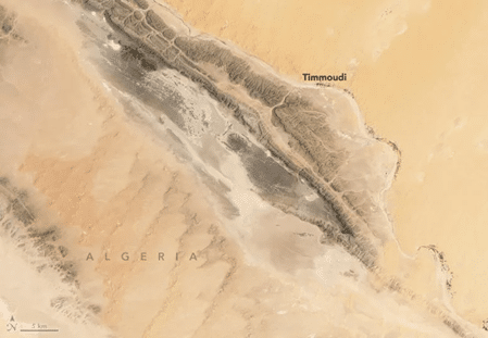
On September 29, 2024, NASA’s Landsat 9 captured an image of Sebkha El Malah, one of the Sahara Desert lakes in Algeria along the Ougarta Range. The filling of the lake started in mid-September due to the runoff from the storm. A previous image taken on August 12 shows the lakebed wrapped in salt before the sudden storm completely transformed this area. By October 16, the lake stretched over 191 square kilometers. It was 2.2 meters deep, which was around one-third of its total capacity, calculated by Moshe Armon, a senior lecturer at the Hebrew University of Jerusalem.
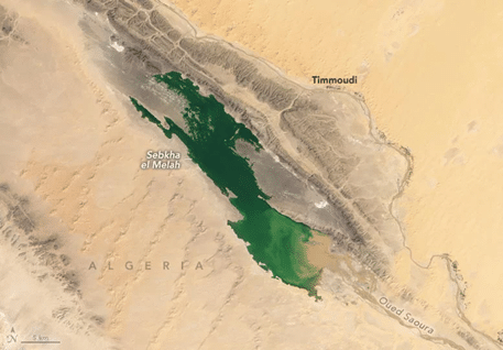
Out of hundreds of refilling events since 2000, only six major rainfalls delivered enough water to refill the Sebkha El Malah Lake. The filling of a Sahara Desert lake is a “rare, largely undocumented, transient phenomenon,” noted Joëlle Rieder, a colleague of Armon’s, in a 2024 study that explained the rate of repetition of refilling events at the lake since 2000.
As per the satellite observations, when these lakes refill, they take years to dry completely. In 2008, Sebkha El Malah filled, and it took until 2012 for it to dry again. “If we don’t get any more rain events, a 2.2-meter depth, like we have now, would take about a year to evaporate completely,” Armon said.
Armon and his team used satellite images and weather data to track the rainfalls that led to the refilling of Sahara lakes. They analyzed rainfall data from NASA’s Integrated Multi-satellite Retrievals (IMERG) and weather analysis data from the European Centre for Medium-range Forecasts (ECMWF) to identify the meteorological conditions required to fill the lakes.
Understanding these events helps researchers to analyze past climate conditions. Scientists are specifically interested in how wet the Sahara was during the African humid period, as evidence suggests that the Sahara was wetter during that period. These events act as natural rain scales that help to measure historical rain patterns. Some researchers said extreme rainfall might have been more frequent during that time, which helped rains to sustain over time.
Due to the unpredictable climatic conditions, researchers are still uncertain about how the Sahara’s climate will be in the future. Hence, by studying the history of rain-filling events, scientists hope to better understand how sudden future climate shifts might impact the region.
Copyright @smorescience. All rights reserved. Do not copy, cite, publish, or distribute this content without permission.
SUBSCRIBE TO OUR NEWSLETTER
.......... ..........Subscribe to our mailing list to get updates to your email inbox.
Monthly Newsletter