Satellite imaging answers everyday questions: How healthy are my crops? Is that construction project on schedule? Where’s the traffic congestion in my supply chain? Detailed views of Earth from space save from rash decisions in any field.
The best part is how accessible satellite technology has become. Everyone can download latest satellite images through simple cloud platforms and immediately get actionable insights. The technology that once required government budgets and scientific expertise has evolved into accessible tools that help solve everyday problems and identify opportunities others might miss.
How Satellites Capture And Transmit Data
Satellites work like high-tech scouts in space, using special sensors to gather information about Earth. Passive sensors detect natural energy (like sunlight bounced back or heat radiated from the surface), while active sensors send out their signals and assess how they bounce back.
The most common sensors include:
- multispectral sensors capture light across different wavelengths, showing us everything from forest health to ocean temperatures;
- radar sensors can pierce through smog, clouds, and darkness by sending microwaves and assessing their return;
- thermal sensors detect heat differences, which is helpful for monitoring volcanic activity or urban heat islands.
Once a satellite collects the latest images, it must send them to Earth. Data is transmitted via radio signals when the satellite connects with the ground station. Low-orbiting spacecraft move quickly and have a brief time to connect with ground stations. Geostationary spacecraft, on the other hand, stay in the same position relative to Earth and are always connected with ground stations. After reaching Earth, the raw data is processed to get those maps and measurements that each of us can use daily.
Types Of Satellite Imagery And Their Uses
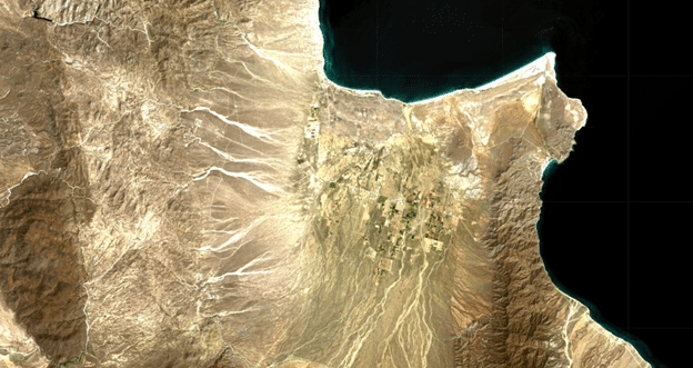
The type of space-derived imagery depends on the sensors used to capture it. Thus, there are three main types of imagery, each with its own perspective to help us solve different tasks:
- Optical imagery, which relies on sunlight, captures Earth in visible and near-infrared wavelengths. It is widely used for observing land cover, vegetation health, and water bodies. High-resolution optical images help city planners map infrastructure and track urban expansion. Environmental scientists use them to monitor deforestation, farmers assess crop health and optimize fertilizing. The only problem is that optical sensors can’t pierce through clouds or take images at night.
- Radar imagery, unlike optical, can capture rain or shine, including cloudy skies and nighttime. Synthetic Aperture Radar (SAR) sends microwave pulses and measures their reflection to create detailed images of the Earth’s features. This makes the latest radar satellite images of Earth invaluable for disaster response, such as detecting flood extent during storms or subtle ground movements that might indicate earthquakes. It is also used to track ice movement in the Arctic and monitor land subsidence in urban areas.
- Infrared imagery detects heat radiated from the Earth’s surface rather than visible light. Thermal images reveal temperature differences across landscapes. The latest infrared satellite imagery helps firefighters identify hotspots hidden by smoke, assists agricultural experts in detecting drought stress before visible symptoms appear on crops, and allows urban planners to identify heat islands in cities to improve energy efficiency.
Despite the strength of each individual technology, their true power lies in how they work together. When farmers combine optical crop health data with infrared drought signals, they can save entire harvests. When disaster teams layer radar flood maps with optical infrastructure images, they literally save lives. And all this happens daily, in real-time, informing countless decisions worldwide.
How Cloud Platforms Make Satellite Data More Accessible
Satellite images that once required PhD-level knowledge to use are now available to everyone through user-friendly platforms. Now, businesses, researchers, and even curious individuals can explore Earth from above without specialized training.
Popular platforms like EOSDA LandViewer work similarly to map applications but offer much more. Here’s what these platforms typically provide:
- Several sources of data. Platforms integrate the latest satellite imagery maps from several open-access (e.g., Sentinel-2, Landsat 8) and commercial satellites, offering diverse views of the same area.
- Ready-to-use data. Pre-processed images on the platforms highlight specific features to simplify analysis.
- Built-in analytical tools. Users can process images with vegetation indices, change detection algorithms, and time-series analysis without requiring specialized software.
- Free options. Many platforms offer basic features and the latest satellite imagery for free, with paid plans for advanced needs.
On top of that, you can download satellite imagery for reports, share findings with colleagues, or make highly detailed analysis in dedicated third-party GIS (geographic information system) software. This accessibility has made space-derived data valuable for small businesses, researchers, and community projects that previously couldn’t afford such technology.
Earth Observation Technologies On The Rise
In the past, satellite Earth observation was used only by scientists. Now, it is a common data source that is used to make decisions every day. The key advancement isn’t just better technology but more accessible data through cloud platforms that eliminate the complex processing previously required.
One major shift is the use of AI to analyze the latest satellite imagery in real time. This reduces delays when making critical time-limited decisions. Private companies are also pushing forward with satellite internet, closing the digital divide in remote regions.
Challenges — space debris, high manufacturing costs, and regulatory restrictions — remain. At the same time, miniaturization and 3D-printed components are lowering the cost and environmental impact of satellite production, and improved methods for removing defunct satellites keep space clear of new debris, promising to gradually solve current problems.
Copyright @smorescience. All rights reserved. Do not copy, cite, publish, or distribute this content without permission.
SUBSCRIBE TO OUR NEWSLETTER
.......... ..........Subscribe to our mailing list to get updates to your email inbox.
Monthly Newsletter