Watching our planet from above has been the subject of significant interest for years. In the Middle Ages and Renaissance, thinkers such as Copernicus, Galileo, and Kepler focused on observing the heavens from Earth rather than observing Earth from space. And the idea of traveling to or observing from space was more the stuff of philosophy, theology, or even science fiction than practical science.
Luckily, today, we have enough technologies and knowledge to have access to real-time visual information about our planet, which is transforming the way we manage land, track assets, and respond to environmental changes. By combining GPS tracking with satellite imagery, users gain a powerful vantage point—one that enhances decision-making across industries like agriculture, forestry, logistics, and disaster response.
But what about an ordinary user? Are these tools and solutions that allow us to track our planet available to anyone? Luckily, yes. From user-friendly web platforms to powerful data processing environments, several services offer intuitive access to high-quality satellite data. Therefore, whether you are just a person with a keen interest in our planet or a multinational corporation that solves ecological challenges around the globe, you will find a relevant solution to get Landsat 8 data for analysis and download, even without spending a dollar. Let’s explore five of the most trustworthy options available today.
USGS EarthExplorer - Trusted by Earth Scientists
EarthExplorer, developed by the U.S. Geological Survey, is one of the platforms for accessing free satellite data. It provides an archive of Landsat data, with historical records dating back over 40 years. Users can filter searches by location, date range, sensor, and cloud cover, making it suitable for precision analysis. The platform supports downloads in various formats, from raw scenes to Analysis Ready Data (ARD). With its preview options and filtering tools, EarthExplorer is a go-to resource for researchers, environmental analysts, and planners alike.
EOSDA LandViewer - Smart Maps for Everyone
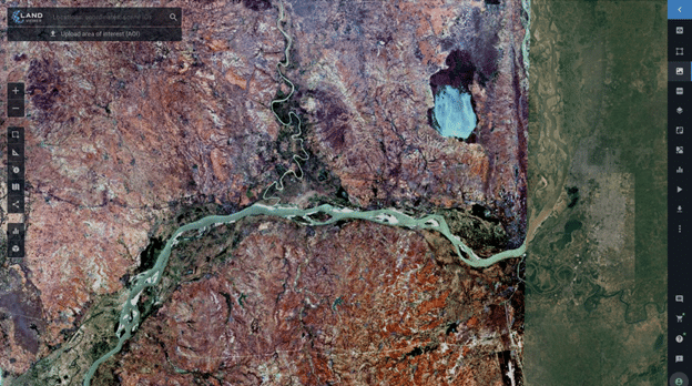
EOSDA LandViewer is a highly accessible, web-based tool that lets you explore, analyze, and download Landsat satellite imagery right from your browser—no specialized GIS software required. It offers seamless access to both recent and historical data from sources like Landsat, Sentinel, MODIS, CBERS-4, and others, making it a versatile choice for users of all experience levels. It features powerful tools like NDVI, SAVI, time-series analysis, and a custom index builder, helping users monitor vegetation, detect changes, or assess environmental impact. LandViewer also offers previews of high-resolution commercial imagery and allows downloads in multiple formats. It’s ideal for professionals and beginners alike.
Sentinel Hub - Fast Filters, Fresh Views
Sentinel Hub is a cloud-powered platform that makes it easy to access a wide range of satellite imagery, including data from Landsat, Sentinel missions, MODIS, and other sources—all in one place. Through its EO Browser and Sentinel Playground tools, users can explore global mosaics or zoom into detailed scenes using search filters. EO Browser allows users to download full-resolution images or individual bands in formats like JPEG, KMZ, or GeoTIFF. While its analysis tools are more basic compared to other platforms, it still supports band combinations, indices, and time-series generation. Sentinel Hub is used to have access to regularly updated Earth observation data.
NASA Earthdata Search - Built for Data Deep Dives
NASA’s Earthdata Search offers access to collections of Earth observation data, including ability to download Landsat 8 data for analysis. The platform aggregates imagery and measurements from missions like Aqua, Terra, GOES, Suomi-NPP, and more, covering topics from climate and vegetation to ocean dynamics and atmospheric conditions. While the interface can be overwhelming for beginners, it’s a strong resource for professionals familiar with geospatial datasets. Though it lacks built-in analysis tools or image previews, its archive makes it an essential hub for advanced users seeking detailed and diverse satellite data.
Google Earth Engine - Crunch Big Data in the Cloud
Google Earth and Earth Engine together offer a suite for exploring and analyzing satellite imagery. While Google Earth provides a 3D interface for browsing global imagery—including Landsat satellite imagery—its companion platform, Google Earth Engine, brings analytical capacities to the table. Earth Engine hosts a catalog of historical and recent satellite data, allowing users to perform geospatial analysis at scale. While standard downloads come in KML/KMZ formats, Earth Engine supports exporting data in more flexible formats for research. It is suitable for developers and scientists, combining accessibility with strong processing capabilities.
Choosing the Right Tool for Your Earth Insight Needs
Whether you’re a seasoned researcher or just beginning your geospatial journey, accessing free Landsat 8 data and other satellite imagery has never been easier. Each platform offers unique strengths, from in-depth analysis tools to simple visual exploration. By selecting the one that aligns with your project’s needs—be it frequent updates, historical depth, or user-friendly interfaces—you can unlock powerful insights about our changing planet without spending a dime.
Copyright @smorescience. All rights reserved. Do not copy, cite, publish, or distribute this content without permission.
SUBSCRIBE TO OUR NEWSLETTER
.......... ..........Subscribe to our mailing list to get updates to your email inbox.
Monthly Newsletter